
HIDDEN GEM
Vuurtoreneiland
A small island with a lighthouse and a fort in the IJmeer, reached only by boat.
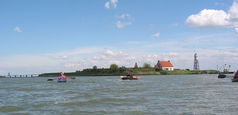
A lighthouse on a strip of land in the IJmeer
Vuurtoreneiland means Lighthouse Island. It is a small island in the IJmeer, just off the coast at Durgerdam, on the eastern edge of Amsterdam. Seen from the water, it is a low line of trees with a slim iron tower and some old brick buildings, and not much else.
That is the attraction. You leave the city by boat and arrive somewhere quiet, with open water on every side and the Amsterdam skyline far off. The island is owned by the Dutch state and managed by Staatsbosbeheer, the national forest service. A daily ferry from Amsterdam serves it, and excursions run there too.
Light, then guns
The island was made around 1700 to carry a beacon, named Hoek van 't IJ after the point on the mainland opposite. The first lighthouse was a square stone building. In 1809 a military post was set up here, and in 1844 it grew into a proper fort. In 1883 it became part of the Stelling van Amsterdam, the ring of forts built to defend the city. Together with Fort Pampus and Fort Diemerdam, it was meant to hold off an attack from the Zuiderzee.
The island was enlarged in 1885 for a coastal battery near Durgerdam. Later a bomb-proof building and an artillery battery were added, but the five guns were moved to Den Helder in 1904. The soldiers left long before the fort was formally struck off as a stronghold in 1959. It has been a Rijksmonument since 1981, and it is part of the UNESCO World Heritage listing for the Defence Line of Amsterdam.
The lighthouse had its own story. The old stone building was replaced in 1893 by the tower that stands today. The fog signal was switched off in 2001. In 2003 the light went out when the last keeper retired, and in 2005 it was lit again. It shone until the end of 2016. Since then the parties involved, from Rijkswaterstaat to the shipping and pleasure-boat sectors, have discussed an alternative beacon in a different colour.
What to look at when you land
Start with the tower. It is octagonal and conical, made of cast iron and steel sections, and you can see through its frame. It has five levels, and the top one, the lantern room, is closed in. Nearby is the keeper's house. The present building dates from 1951, as the first keeper's cottage was replaced.
Then look at the ground. The low shapes and brick buildings are what remains of the fort, and the former barracks are among them. A restaurant has used the island since 2013 as a reuse project. In summer it sits in a glass house, and in winter it moves into the old barracks. The island has also hosted outdoor theatre: in September 2012 neighbours from Durgerdam and the surrounding area staged a show called Ik, een eiland, meaning "I, an island".
A narrow bridge has linked the island to the mainland since 1996. Look north too. A low dam, the Hoeckelingsdam, was built in 2003 to give a stretch of the IJmeer some shelter from the wind. It does not touch the island and the public cannot walk on it. To the south, work began in 2023 on a new artificial island, the Buiteneiland. The old fort now looks across the water at a new piece of land under construction.
The IJmeer is a wide, open stretch of water, and weather changes the whole feel of the place. On a clear day you can see how the lighthouse once worked: one iron tower, a lot of water, and ships steering by it.
Before you go
- Go by boat. The sources mention a daily ferry from Amsterdam and organised excursions, so check with the operator for the current schedule.
- Choose a clear, calm day if you can. The island is open to the wind, and the views across the IJmeer are best in good light.
- Wear a windproof layer and sturdy shoes. Paths on an island with an old fort can be uneven.
- Bring a camera for the iron tower and for the Amsterdam skyline from the water.
- The Hoeckelingsdam to the north is not open to the public, so do not plan to walk out onto it.
What people say
Related spots
More things to do in Amsterdam ›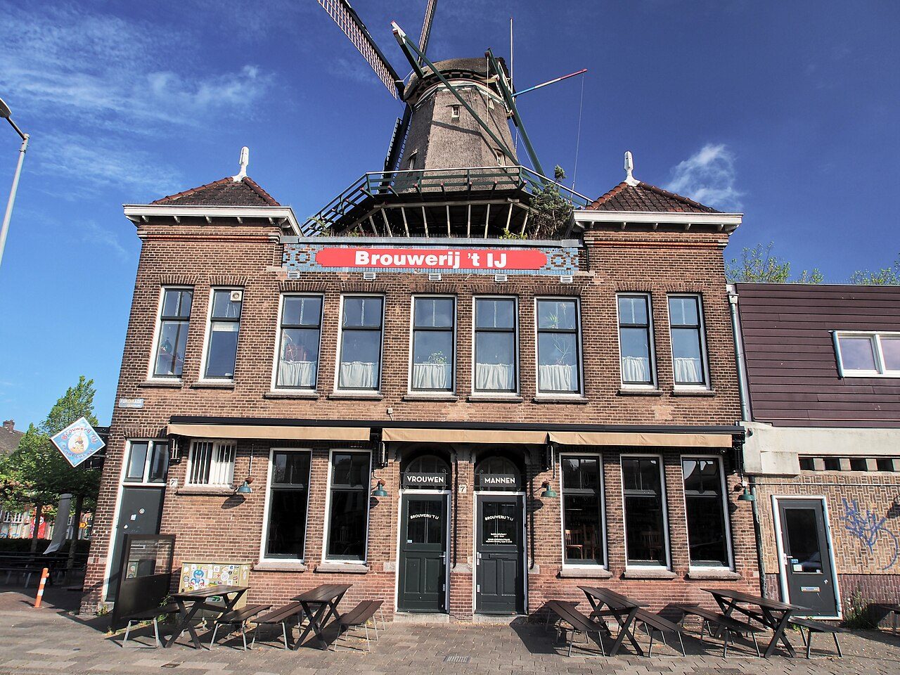 TASTE
Brouwerij 't IJ
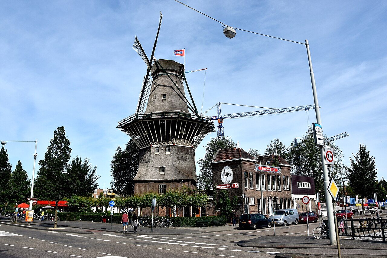
Amsterdam's best-known craft brewery pours its beer in an old bathhouse at the foot of De Gooyer, the tall wooden windmill on the Funenkade.
 HIDDEN GEM
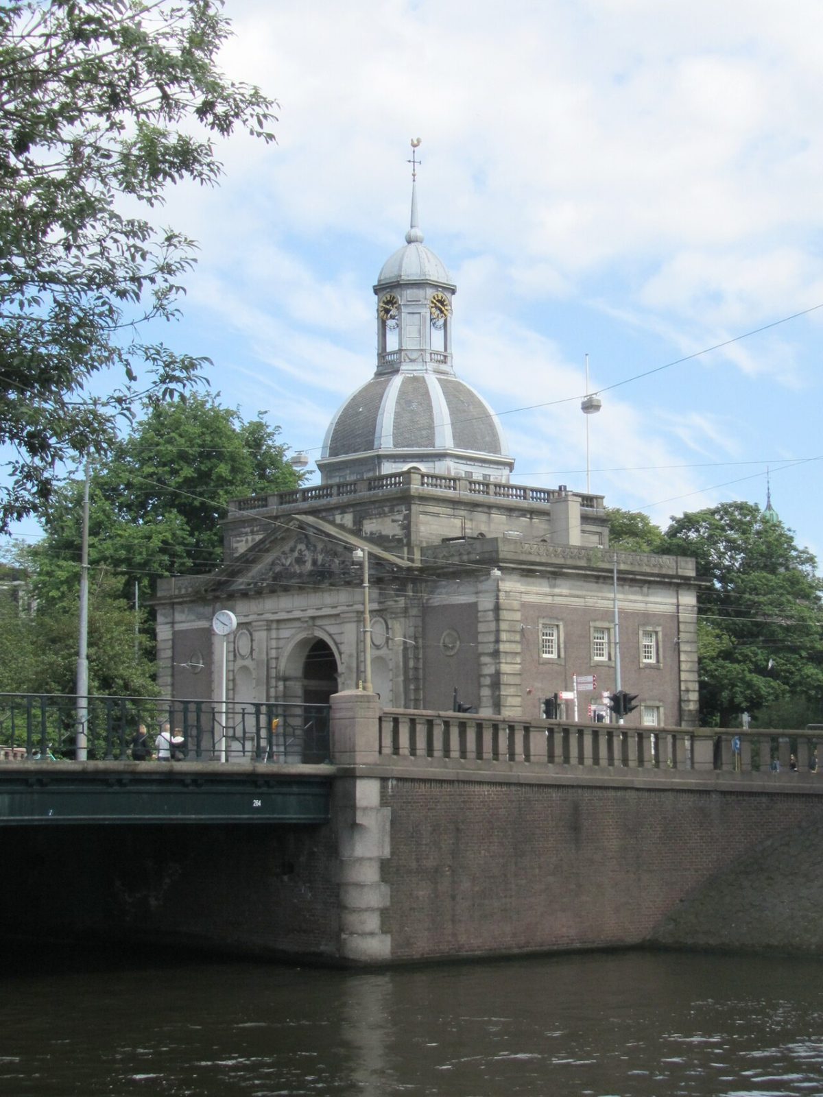
Muiderpoort
The 1770 city gate through which Napoleon rode into Amsterdam in 1811.
 LANDMARK
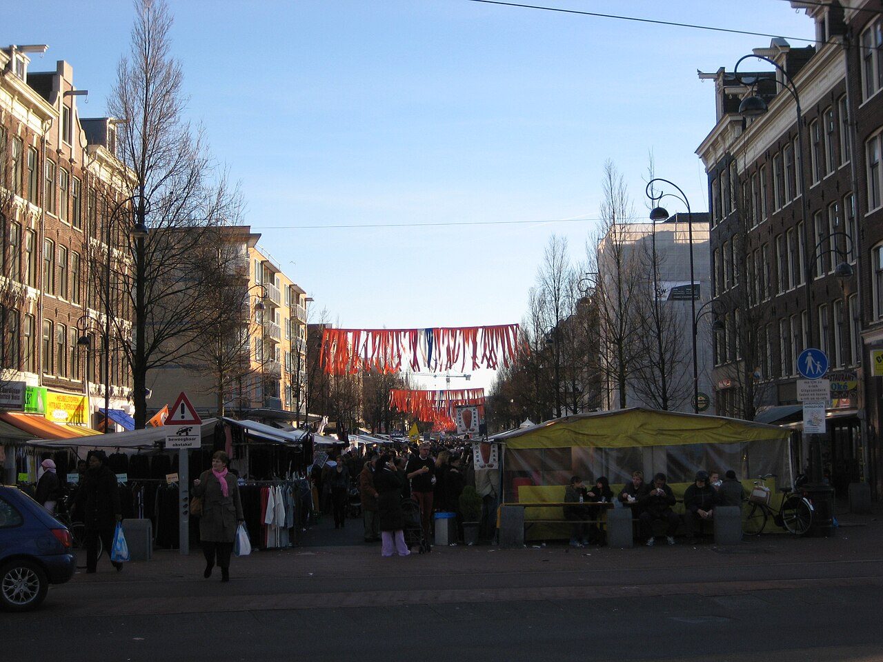
Dappermarkt
The everyday street market of Amsterdam-Oost, where locals do their shopping.
 LANDMARK
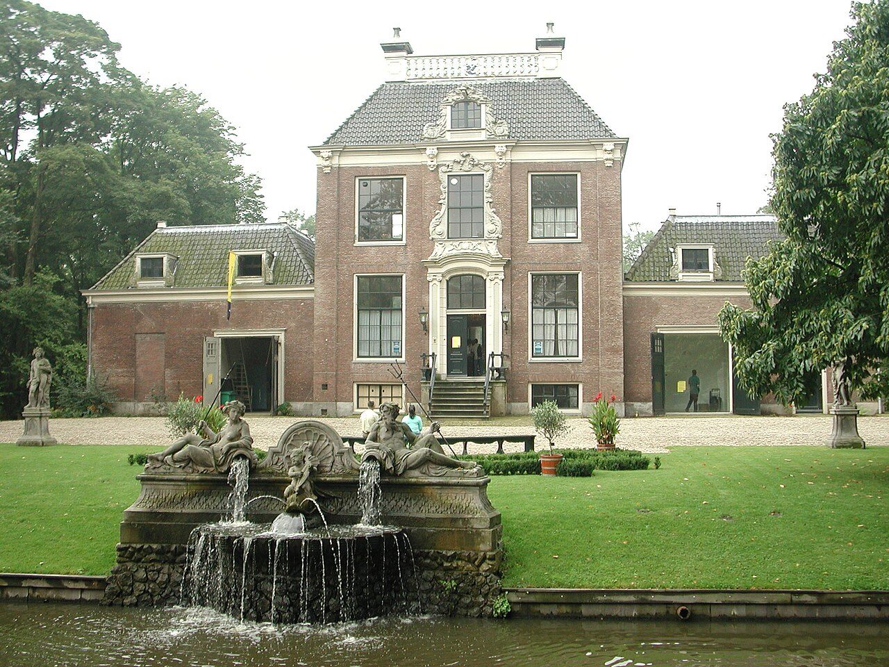
Park Frankendael
The last 17th-century country estate inside the city, with a formal garden and a ruined gate.
 LANDMARK
Molen De Gooyer
The tallest wooden windmill in the Netherlands, right next to Brouwerij 't IJ (already on the map).
 HIDDEN GEM
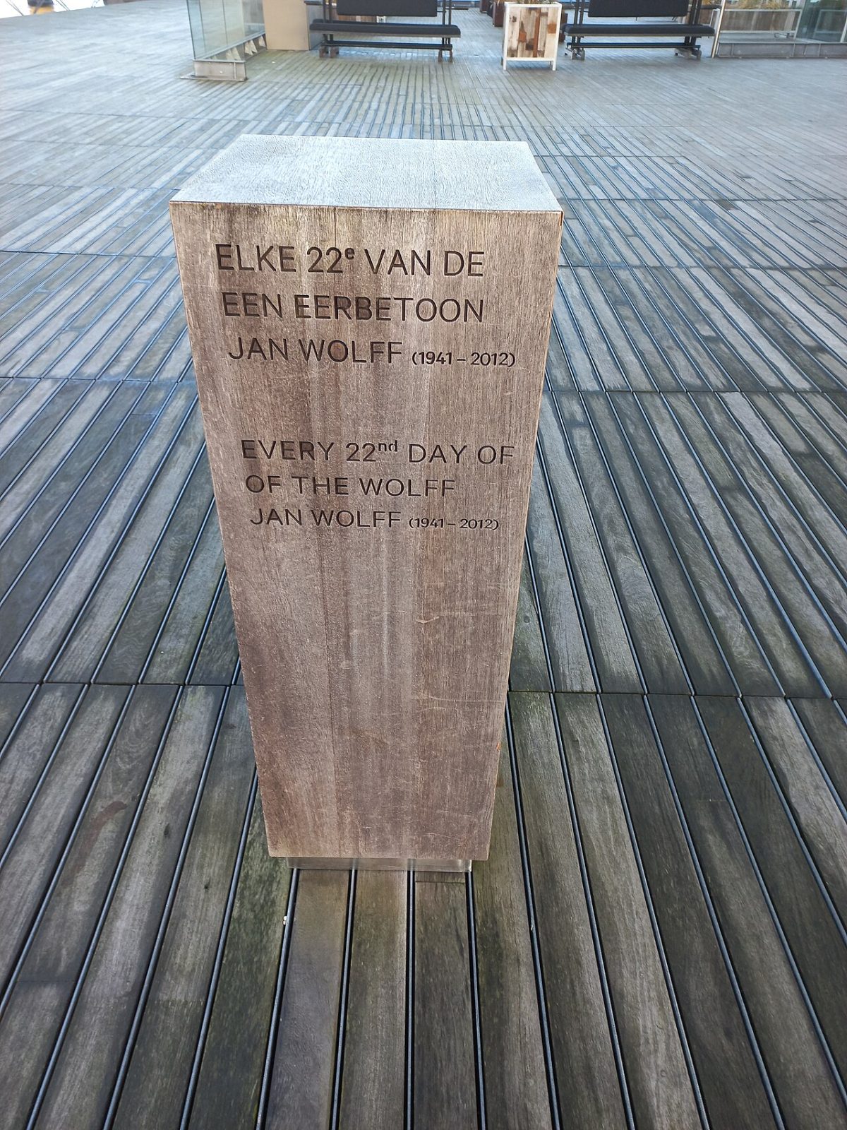
Huil van de Wolff
A sound monument under the overhang of the Muziekgebouw for horn player Jan Wolff: every 22nd of the month at 8 pm it plays wolf howls, ship horns and lapping water, shaped by the weather.
Walk it with a guide or a quest
If you want a story on the way, these walks also live in Amsterdam.
 AUDIO TOUR
Amsterdam Ghost Tour
Plague pits, public executions and the canal that swallowed people. The city's grim side, told without the cheap scares.
 AUDIO TOUR
Amsterdam in a Day: Highlights Walk
Start here if it's your first day. Why the houses lean, how the canals were dug, and what the Golden Age was actually built on.
 AUDIO TOUR
Red Light District
Seven centuries of sailors, sin and stubborn tolerance. The real history of the oldest part of town, told straight.